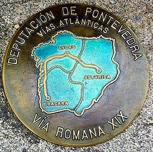
Vías Atlánticas - Vías romanas
Ville la plus proche:
Vilagarcía de Arousa
Pontevedra
Spain
This Roman road, also known as the Antonine Itinerary (Bracara Augusta - Lucus Augusti), dates from the 2nd century C.E. and connects the former Roman conventus (administrative districts) of Braga and Lugo. It was the longest road in the northwest of the Iberian Peninsula, about 500 kilometres long.
Roman roads were built by the Roman Imperial State in order to articulate the territory and to join the capital cities of the different Conventus Iuridici (administrative capitals of the Roman era).
These ancient roads acted as an important backbone and a key factor in socio-economic and commercial dynamization. In addition, they had many other functions: strategic and military (defence, transportation of troops), fiscal (tax collection, people and goods control) and contributed to the reorganization of the territory.
It connected the cities founded by Emperor Augustus in Gallaecia, Bracara Augusta (Braga) and Lucus Augusto (Lugo), reaching Asturica Augusta (Astorga), in order to provide the troops in the northwest of the Iberian Peninsula with basic goods (wheat, wine, salt-preserved foods…), which gave the infrastructure a great commercial value.
This Roman road goes from Tui to Pontecesures and passes through Pontevedra, and the itinerary can be completed in 4 stages:
1st stage: Tui - Redondela
2nd stage: Redondela - Pontevedra
3rd stage Pontevedra - Caldas de Reis
4th stage Caldas de Reis - Pontecesures
Notez cette ressource
Typologie de l'itinéraire
Linéaire
Longueur totale (km)
100 km
Cartographie I.G.N.
Hojas I.G.N., escala 1:25:000. 185-II, 152-IV y 152-II
Intérêt paysager des environs
Modéré
Description de l'environnement
Rural
Difficulté
Sous
Itinéraire (M.I.D.E.)
2
Déplacement (M.I.D.E.)
2
Effort (M.I.D.E.)
2
Moyen (M.I.D.E.)
2
État de conservation
Bon
Matériau recommandé
Ropa y calzado cómodo


